Area History
The following is a history of the Happy Canyon area compiled by resident David Cragie:
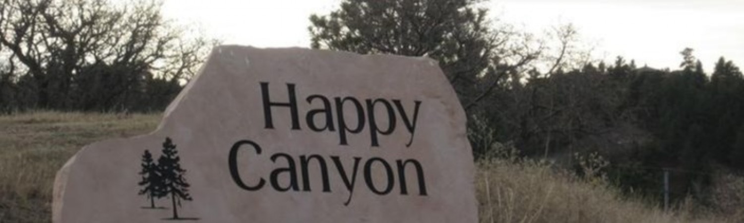
The History of Happy Canyon
While the modern history of the Happy Canyon subdivision began with the plat filings in May of 1962 with the Douglas county government, the area around Happy Canyon Road has a rich history. It is my attempt with this document to recount some of the history for our wildfire protection plan in order to tell our story and hopefully to preserve it for future generations of Happy Canyonites. It is not my design to recount all the history of Douglas County. While the cities of Parker, Louviers, Larkspur and Highlands Ranch have colorful pasts, they generally don't play a direct role in the development of our Happy Canyon. Other towns like Franktown, Sedalia and Castle Rock and a few now extinct townships such as Douglas, Citadel and New Memphis, are important and while their stories won't be exhaustive in this essay, you will see their names throughout the account. One more provision: I have tried to be as accurate in my reporting as possible. In some cases, names of people were different from source to source and yet their stories were the same. In other instances, dates varied. For instance, the establishment of New Memphis is reported to have occurred in 1864, 1871 and 1874 in three separate sources. I have therefore had to choose between sources for names and dates. Where the name was the same in more than one source, that is the name I chose to use. Where the dates differed, I picked one. Therefore, please forgive any inaccuracies in this narrative.
Indians
Perhaps the first settlers in modern history of Douglas County were the Indians. It is thought that they were in the area at least 200 years before the first white men arrived. While there were 7 Indian nations represented in the county, 3 were prominent: the Arapahoe, Cheyenne and Utes.
The Utes represented the oldest continuous inhabitants of the county, were an offshoot of the Shoshone tribes and were of the same linguistic family as the Aztecs. They traded Buffalo products with the Spanish explorers and lived mostly in the mountains in the west end of the county. They were very dark-skinned and were often called, "Black Indians," or the "Black Army".
The Arapahoe and Cheyenne were descended from the Algonquin tribes who dominated the fur trade in the Northeastern US. They gradually migrated west hunting Buffalo and while they were from the same common ancestors, the years made them separate peoples such that their languages were quite different. The Arapahoe settled in the foothills of Douglas County and served as translators and business middlemen for their distant cousins the Cheyenne who settled the eastern plains of the country. These "plains" Indians were tall with big noses and lighter-colored skin and became to be known as the "Big-Nosed People".
The Utes were very warlike and constantly fought with the plains tribes. Part of the conflict was fueled by racial hatred. Much of the fighting, however, had to do with land and resources. South Park, in particular, was a rich area for buffalo and salt from the salt marshes there. The plains tribes would often travel there for hunting and the salt but had to travel through Douglas County in order to get to Ute pass near Manitou Springs The Utes resented this intrusion onto what they claimed as their land and fought ruthlessly to protect their interests. Often they would make raids down out of the mountains to attack the plains tribes and then scurry back to the protection of the Rockies. The plains tribes would often send war parties in pursuit only to find that the Utes had set forest fires to guard their retreats. This practice was actually witnessed and recorded by some of the earliest explorers in the county. Forest fires and Douglas County are no strangers.
The Arapahoe believed that the Great Spirit Manitou had placed the Rocky Mountains in the west as a barrier to separate them from the Utes. Their fear was that the Utes would come and steal their women to breed with and make themselves taller and lighter-skinned. Thus the springs in the Manitou area became reserved as a neutral sanctuary where all could come and pay homage to the Great Spirit. As there was always a peace in Manitou Springs, the Indians came to worship the Great Spirit unarmed.
The earliest white settlers of the Round Top area, (our modern-day Happy Canyon) found day trails in the area, especially along Newlin Gulch, just north of our neighborhood. Legend has it that the Indians on such journeys would lay down their weapons of war on the mesas on their way south.
Daniel C. Oakes
In October of 1858, Major Daniel C. Oakes, a veteran of the California gold rush, and his party of five headed for the goldfields of Colorado. They made camp on the west side of Cherry Creek on the opposite bank of the new town-site of St Charles. This gives him and his party the distinction of being the first group of settlers on the future site of Denver. They traveled further south along Cherry Creek and ended up in William Green Russell’s camp five miles south of present day Franktown where they had managed to pan only $3 to $5 of gold per man. Disappointed, Oakes returned to Iowa for the winter but he took with him a journal of one Luke Tierney, a prospector with the Russell group. With partner Stephen Smith, Oakes edited the journal and published History of the Gold Discoveries on the South Platte River by Luke Tierney To Which is Appended a Guide to the Route by Smith and Oakes. The book was published in Pacific City, Iowa but was circulated to all points of departure west along the Missouri River. As a result of this and some 19 other such books, some 150,000 people migrated west in the spring of 1859 becoming known as the "59er’s."
Meanwhile, Oakes, sensing the monetary potential of the blossoming gold rush, purchased a sawmill and on March 20th, began his second journey to Colorado along the Platte Trail. As many scrambled to be first to the gold fields, newer routes sprang up as shortcuts. One of these trails became known as the Smokey Hill Trail. Lacking the settlements and water of the more established but longer Platte River Trail, many parties failed to reach Denver, starving along the way. One party even resorted to cannibalism to stay alive. Thus the Smokey Hill Trail became known as the Starvation Trail, a piece of history our 5th graders study. This fact, along with the exaggerated claims of gold discoveries turned some 50,000 of the settlers back to the east. Oakes met some of these disgruntled people in Julesburg and they threatened to kill him. Silver-tongued, Oakes managed to talk his way out of the dilemma and continued his journey. But along the trail, he found three mock burials with epitaphs along the lines of, "Here lies D. C. Oakes who was the starter of this damned hoax." Having been warned to avoid the gold camps along Cherry Creek or be hanged outright, Oakes moved south into Douglas County and set up the mill along Plum Creek near the present day road that connects U.S. Hwy. 85 with Daniel’s Park Road. It was among the first, if not the first sawmill in the Pikes Peak Region. One year later, Oakes set up a second mill and took advantage of the burgeoning rush towns of Denver City to the north and Colorado City (Colorado Springs) to the south. The neighborhood we know as Castle Pines North and the Daniels Park area was once a heavily forested area. Oakes’ mill, capable of processing 20,000 feet of lumber daily, did considerable damage to the area, deforesting acre after acre. But more on this later.
Kit Carson
Another visitor of note to Douglas County in the 1850’s and 60’s, and friend of Oakes was Kit Carson. In the mid 1850’s, Carson was a trapper and guide in and around Douglas County. He was also an invaluable agent for the US government in negotiating with the Indian tribes. In 1862, he negotiated the return of a captured Arapahoe squaw from the Utes averting a larger scale conflict. When the Indians got frustrated, they often sought retribution by attacking the white settlers.
Because of his success, in 1868 the government requested his presence at a peace conference between the Utes and the US in Washington. He was not well, suffering from an old wound he had obtained in an accident during the campaign against the Navajos. Chief Ouray, Oakes and others had gone by stagecoach to Cheyenne then took the railroad to Washington. In the nation’s capital, Carson successfully negotiated for the removal of the Indians to reservations. After this, he returned to Denver, still ailing. Oakes took charge of him there and decided to help Carson return to his home in Taos. Twenty-five miles south of Denver, on Wild Cat Point or Riley Hill as it became known later, Oakes and Carson lit a campfire. This event, Kit Carson’s Last Campfire in May of 1868, is commemorated by a marker erected in 1923 on Riley Hill near where The Preserve Golf Course clubhouse stands today. Oakes and Carson traveled on to Fort Lyons where Carson succumbed to his injury on May 24th, 1868.
Happy Canyon, The Original
The original Happy Canyon ran from the rocky cliffs east of Daniel’s Park, toward Surry Ridge then north along modern I-25 to Newlin Gulch. In the harsh winter of 1859, John Craig, Jack Johnson and Charles Holmes settled in this canyon where they engaged in mining and raising cattle. As food and supplies were in high demand, things were very expensive and so the trio subsisted mainly on wild game that was abundant. When their clothes wore out, they made due with buckskin. John Craig later purchased the Round Corral now known as Sedalia. Charles Holmes is lost to history. But Jack Johnson stuck around.
John Schweiger, an Austrian emigrant, came to the United States when he was 21 years of age seeking a better life. He first lived in Georgia and Tennessee working in the mines. In 1869 he moved west and was hired by Tabor’s Sampling Mills in the Leadville area. In 1874, desiring to develop a cattle ranching business, John, with two of his brothers, Jacob and Joseph, purchased what would come to be known as Happy Canyon Ranch. Eventually, they sent to Austria for their parents and the whole family settled in a small cabin near a creek. In order to continue to earn money to pay the bills, Jacob and Joseph worked in mining towns. The money earned by them was used to build a ranch house and outbuildings between 1894 and 1910 and some of them were used for over 100 years.
After their mother died, the brothers decided that one of them must marry in order to have a woman for domestic chores such as housekeeping, cooking and laundry. John drew the short straw and in 1885 married Anne Schneider and eventually fathered seven children with her.
As the brothers prospered, the size of the ranch grew. On the property there was a small grove of trees that also contained a small cabin used on occasion by cowboys during roundup. One summer, one Jack Johnson asked to stay in the cabin and John agreed. Jack moved in and soon after graced the Schweigers with his guitar and singing. The singing proved a happy distraction for the family and so, when asked the name of the ranch, John would reply, "Happy Canyon." One day the music didn’t play and John went to the cabin to check on Jack finding that he had left, never to be heard from again. But the name Happy Canyon stuck.
The Schweiger’s became a prominent family in Douglas County becoming involved not only in ranching but also in real estate and commerce with one descendent opening a gas station in nearby Castle Rock. The ranch was operational until 1965 and now serves as an example of life in the west in the time of the Homesteaders. Located on the property are remains of the Arapahoe Canal, an early example of irrigation in the semi-arid high western plateaus. The ranch buildings can still be seen just east of I-25 at exit 191.
New Memphis and Citadel
The earliest visitors to the Castle Rock area often remarked on the beauty of the rock formations. John Fremont and his party, traversing the county in 1843, called it "pound-cake rock," an ironical name they invented to distract themselves from the hunger they were experiencing at the time. In 1858, David Kellogg, who had come to pan the headwaters of Cherry Creek, viewed the butte and was the first to call it Castle Rock.
In 1862, Congress passed the Homestead Act so as to help develop the west. Thus many entrepreneurs formed businesses designed to settle the lands. Soon after, a group of settlers, including one John Harris, followed the dream and established a town-site two miles north of the castle rock. But they thought the rock looked more like a battlement and so called their settlement Citadel. In 1864, another group, which included John Harris’ brother Thomas and 50 others, set out from Tennessee under the auspices of the South Western Colony Company. Thomas along with his brother platted out a new township a short distance from Citadel and they called it New Memphis. These towns were located roughly where the Justice center sits today along I-25. For a time, New Memphis was a happening town that overshadowed its upstart neighbor, Castle Rock, to the south. The principal employment of the townspeople, as reported in an 1876 newspaper account, had been, "horse racing, gambling and drinking forty-rod whiskey." This was soon replaced by, "a quiet country store, a hotel, a few houses…quite a trading point." In 1872, New Memphis opened a post office. Mail was taken to the town of Douglas, two miles south of fledgling Castle Rock by rail, and then transported by horse and buggy to New Memphis, -and distributed to the
settlers of Castle Rock.
In 1872, things got heated. There was a battle for the establishment of the Douglas County Seat. Douglas County’s original county seat was Frank(s)town that was a logical location as it was near the Russellville gold rush and was at the confluence of several major transportation routes. In 1874, Elbert County was formed partly from the eastern half of Douglas County and so Franktown was no longer in the center of commerce and the Railroad had constructed new lines further west. So interest in moving the county seat west became keen and the competition stiff. In the running were Franktown, Castle Rock, Sedalia, Douglas, New Memphis and a town named Glade. The draw for Castle Rock was the flat land at the base of the rock with plentiful water 14 feet below the surface. The drawback was that the railroad went through Sedalia, New Memphis and Douglas, not Castle Rock. But the landowners in Castle Rock donated 40 acres for government buildings and that swung the vote their way. The Harris brothers were not to be outdone. Rather they packed up New Memphis/Citadel, buildings and all and moved them to Castle Rock. There they established the Harris Hotel.
Plateau Quarry
In the early 1870’s, Silas Madge, a local rancher and frustrated gold-rusher, still enchanted by the dreams of precious metal, climbed a flat-topped butte near his ranch. He sunk a few prospect holes and in every one found a pinkish-grey lava stone. Disappointed but undaunted, he sent samples of the stone to a Denver Assay office. The report that followed stated that while there was no precious metal in the samples, the stone would serve as excellent building material. So began the Castle Rock Quarry industry. In 1872, Madge opened his quarry on a butte south of Castle Rock. The railroad caught on and built a spur to his quarry so that the rock could be transported easily. Soon other quarries opened: the O’Brien Quarry 3 miles east of the Madge Quarry on Lake Gulch Road and the Santa Fe Quarry located west of Castle Rock and now serves as the site for the Red Hawk Subdivision. Before Silas Madge launched the quarry fever in the county, another, lesser-known quarry was already in operation. This was the first "uniquely topped mesa" to be worked for stone in Douglas County and was known as the Plateau Mesa. The stone from this mesa was said to be beautifully variegated and was used for foundations, granaries and schoolhouses. Fonder School on Cherry Creek used stone from the Plateau Quarry, as did the Dewey School built just south of the quarry in 1898. We know the Plateau Quarry as the large hill just south of our own Mesa with the radio towers on the top. If you look, you can still see the horse trails up its side and the piles of rock tailings near the top.
Round Top, Our Happy Canyon
South of the original Happy Canyon lies the Round Top district, named for the round knob rock formations on the tops of the buttes. Round Top Mountain is our very own mesa and was revered by the Indians for its unique visibility. From there one can see Parker, Devil’s Head, Pikes Peak and Denver. It is here, according to legend that the Indians put down their weapons on their way to Manitou Springs.
In 1884, John M Chase came to Douglas County with his three sons, Sylvanus, Frederick and John Jr and homesteaded the Happy Canyon-Roundtop area. He was the first treasurer of Michigan University and was an early settler in Detroit in 1838. When the capital of Michigan was moved to Lansing, he gathered up the state funds and drove to Lansing. Along the way, the wagon broke down and so he finished the final 50 miles on foot, the state’s funds on his back. Mr. Chase was an advocate of reforestation. Concerned about the devastation of Oakes Sawmill operations, he planted over 7000 blue spruce and white and yellow pines on these hills and other devastated hills throughout Colorado and assisted in setting out 10,000 more seedlings. He died at the age of 93 in 1904.
Mr. Chase’s sons formed the Happy Canyon Land and Cattle Company and amassed some 3000 acres stretching from the Beverly Hills area north of Castle Pines Parkway to the Nursing Home at the foot of the Plateau Quarry. John Jr became an ophthalmologist and was also a Brigadier General in the Colorado National Guard during the strike-filled days of the early 1900’s. He maintained order during a particularly nasty miner’s strike in Cripple Creek and helped with the Ludlow strike prior to 1916. In spite of being caught in the middle between angry miners and mine owners, General Chase maintained his reputation as a "splendid citizen…the peer of any citizen in Colorado in honesty and ability."
General Chase would often bring his troops to Round Top for maneuvers. One of these exercises involved putting artillery on top of our mesa and firing across the valley (our neighborhood) at targets set up on top of the old Plateau Quarry. One-author states, "I have often wondered if some of today’s Happy Canyon landowners on the quarry have not found some of those big shells. The targets wasted away over the years up there in the scrub oaks. We used to come across them when we rounded up cattle. That caused quite a thrill." So attached to the mountain did General Chase’s troops become that they came to be known as the "Round-Top Cavalry."
The land that makes up our neighborhood was homesteaded to many people, including the Chases from 1870 to 1919. The first platting of Happy Canyon was approved by the Douglas County Commissioners on June 7th, 1962 and included the head of the canyon, Strawberry Lane, Buckskin Lane, Wrangler Road, Posse Road, Meadow Lane and, of course, Lariat Drive. The rest of the Lariat part of the neighborhood soon followed with the Mesa Drive areas coming on later plats. And the rest, as they say, is history!
Resources
Castle Rock: a grass roots history
by Robert L. Lowenberg
Lowenberg; Englewood, Colo.: Printed
by Quality Press, 1986
Douglas County: a historical journey
Josephine Lowell Marr; compiled by
Joan Marr Keiser J.L. Marr; Gunnison, CO: B & B
Printers, c1983
Douglas County, Colorado: a photographic journey
by the Castle Rock Writers
Castle Rock, Colo.: Douglas
County Libraries Foundation, c2005.
Douglas County Libraries' webpage on the book
Happy Canyon named after happy singer called ‘Jack’
by Ruth Miller, Time Traveler,
Douglas County Press
Walk with our pioneers: a collection
by Alice M. Thompson.
Grand Junction, Colo.: JLM Sales,
2005.
Publisher's website
I received a lot of help from the Douglas County Library and staff and resources they have at the Wilcox Branch.
There is also a Douglas County Historic Preservation web site which was of great help. It can be accessed through the Douglas County Website.
Pages
- Home
- Area History
- Area Map
- Happy Canyon Photos
- Happy Canyon HOA
- HOA Governing Documents
- HOA Community Documents
- HOA Board
- HOA Committees
- HOA Meeting Minutes & Agendas
- HOA Community Correspondence
- HOA Wildfire Protection Plan
- HOA Helpful Documents
- Happy Canyon Estates Lot Map
- Happy Canyon Community
- Community Alerts
- Community News
- Community Events
- Community General Forum
- Community Pets Directory
- Community Recipe Exchange
- Community Classifieds
- Community Directory
- Helpful Contacts & Links
- Pay Voluntary Annual Dues
- FAQs
- Contact Us